

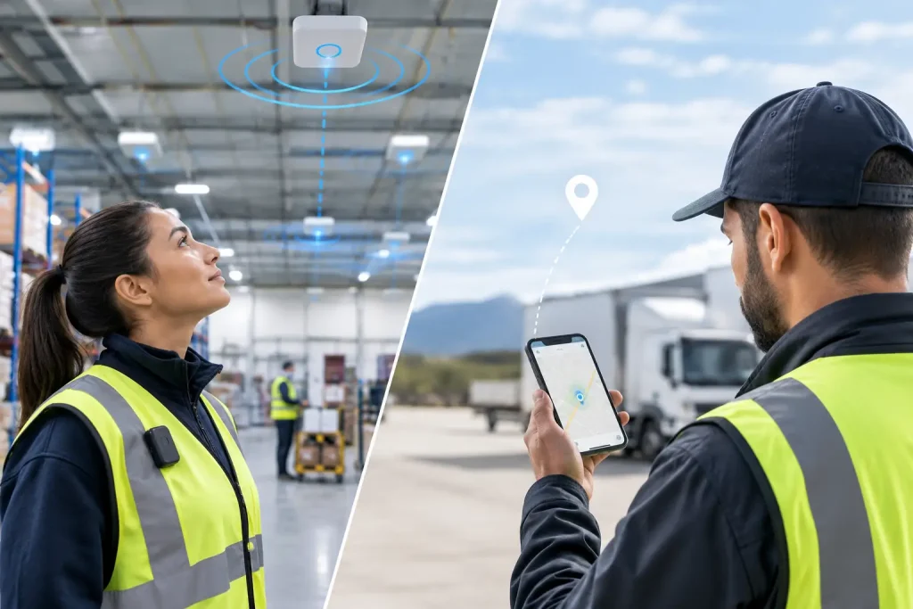
A worker clocks in at a distribution centre, completes checks across several indoor zones, then travels to another site. GPS may confirm the journey, but it cannot reliably establish which loading bay, ward, floor or work area they occupied. That is the practical RTLS versus GPS workforce decision: use GPS for outdoor movement, use real-time location systems for meaningful indoor visibility, and combine them where work crosses both environments.
The right choice is not about collecting more location data. It is about collecting enough evidence to answer an operational question and trigger the right action: were contracted hours worked, was a task completed in the right place, is a lone worker safe, or is everyone accounted for during an evacuation?
RTLS versus GPS workforce tracking: the core difference
GPS, or Global Positioning System, uses satellite signals to estimate a device’s position outdoors. It is well suited to vehicle routes, mobile engineering teams, delivery activity and travel between sites. A mobile phone or vehicle unit can report a location coordinate, time and movement history when it has a suitable signal.
RTLS means real-time location system. It is a category of technologies designed to identify the location of people, equipment or assets within a defined environment. Depending on the deployment, RTLS can use fixed gateways or readers, badges, tags, sensors and technologies such as Bluetooth Low Energy, RFID, Wi-Fi or ultra-wideband. It can show that a person entered a site, passed through a zone or is located in a particular operational area.
The distinction matters because satellite signals are often weak, reflected or unavailable indoors. GPS may indicate that someone is at a large building, yet it cannot reliably determine whether they are on the shop floor, in a staff area, at a client location or outside the premises. RTLS is designed to make location evidence useful inside the building.
| Question | GPS | RTLS |
|---|---|---|
| Best environment | Outdoor and between-site travel | Indoor sites and defined operational areas |
| Typical evidence | Coordinates, routes, journeys and stops | Site presence, zone entry, movement and event location |
| Infrastructure | Usually device-led, reliant on satellite visibility and connectivity | Often requires site hardware such as gateways, readers or sensors |
| Strong workforce use | Mobile field teams and fleet-related work | Attendance, task validation, safety and roll-calls |
Neither option automatically proves productive work. Location is evidence, not a verdict. A sound workforce process combines location with time, scheduled shift, task status, approvals and any relevant safety event.
When GPS is the better workforce tool
GPS is usually the sensible starting point when the work itself happens outside. A highways maintenance crew, mobile care team, field engineer or security patrol working across a wide geography may need evidence of travel, arrival and time spent near a customer or work location.
For these teams, GPS supports practical questions: has the operative reached the allocated area, is a vehicle still on route, has a scheduled visit been made, and is a worker operating alone in an area where escalation may be needed? It can also reduce manual check-in activity where the location signal is sufficient for the decision being made.
However, GPS has limits even in outdoor operations. Urban streets, covered areas, tall buildings and poor handset conditions can affect results. It also describes proximity rather than intent. A coordinate close to a site does not necessarily validate a specific inspection, cleaning task or handover. If the operational question is whether a task was done, task evidence should be captured alongside location and time.
When RTLS is the better workforce tool
RTLS is a stronger fit where the workplace is a physical operating environment with important internal zones. That includes warehouses, hospitals, manufacturing sites, retail estates, hospitality venues and facilities management contracts.
Consider a facilities team responsible for several floors of a large building. A site-level GPS point offers little help when a supervisor needs to know whether coverage is present on the correct floor, whether a required round reached a particular area, or where a worker may be during an incident. Location-aware badges, tags, gateways or other workplace hardware can create evidence that software alone cannot directly capture.
RTLS can support verified attendance when it records a worker’s arrival at a defined workplace or zone alongside their clock event. It can support proof of service where a workflow requires location confirmation before a task can be closed. It can also improve emergency response by helping teams build a more current picture of who may be on site and where they were last detected.
The level of precision should match the decision. Many workforce processes need zone-level evidence, such as entry to a ward, warehouse aisle or restricted area. They do not necessarily need precise, continuous coordinates. Designing for the question reduces cost, complexity and unnecessary data collection.
Mixed teams often need GPS and RTLS together
A false choice between RTLS and GPS can create gaps in the evidence trail. A regional engineer may travel by road, arrive at a customer site, collect parts from an indoor store and carry out a safety-critical task in a plant room. GPS is useful during the journey; RTLS may be useful once the person is within a configured workplace.
The same applies to multi-site operations. A system should be able to connect a person’s shift, clocking, assigned work, outdoor travel where appropriate, indoor presence and reported events without forcing supervisors to reconcile separate tools and spreadsheets.
Sense Tech can act as the operating layer for this type of frontline work, connecting workforce processes with location-aware hardware and operational workflows. The useful outcome is not a map for its own sake. It is a clearer, time-stamped record that helps managers resolve a missing-hours query, validate service coverage, support an emergency roll-call or investigate an exception quickly.
Choose the technology from the operational decision
Before selecting hardware or tracking methods, define the decision that location data must support. The following questions expose whether GPS, RTLS or a combined design is appropriate:
- Is the work mainly outdoors, indoors or split across both?
- Do managers need site-level confirmation, zone-level presence or a more precise location?
- Is the priority verified attendance, service proof, worker safety, emergency response or route visibility?
- What event should follow the signal: a payroll review, missed-task alert, welfare check or escalation?
- Can the workforce carry a mobile phone, or is a badge, wearable, tag or fixed clock more suitable for the role?
A warehouse may choose defined zone events to validate safety checks and attendance. A field service operation may use GPS arrival evidence with task completion steps. A healthcare setting may prioritise fast location context for an SOS or fall event. These are different workflows, so they should not be forced into the same tracking model.
Design location data for privacy and trust
Workforce location projects fail when they are introduced as surveillance rather than a defined operational control. Employees should understand what is captured, when it is captured, why it is necessary, who can see it and how long it is retained. Managers also need clear rules: location evidence may identify an exception, but it should not replace fair investigation or context.
For UK employers, location data can be personal data. The organisation should establish a lawful basis, carry out an appropriate privacy assessment, apply data minimisation and consult its privacy, HR and employee-representation processes. ICO guidance is a useful reference point, particularly where monitoring could be intrusive or continuous.
Practical controls make a material difference. Limit data capture to working time or relevant locations where possible. Prefer zone events over constant tracking when zone evidence is enough. Restrict access by role, record the purpose of reports and make sure workers have a clear route to challenge inaccurate records.
Implementation: start with one evidence gap
The best first deployment is usually a contained operational problem, not an estate-wide tracking programme. It may be disputed clock-ins at one site, uncertainty during fire roll-call, lack of proof for cleaning rounds or lone-worker escalation in a high-risk area.
Map the current workflow first. Identify what the team knows now, what they have to assume, where evidence is missing and who needs to act when an exception occurs. Then test the real environment. Materials, layout, signal coverage, device habits and shift patterns all affect whether a location design will work as intended.
Run a pilot with agreed success criteria. Check whether the data is understandable to supervisors, whether it reduces manual follow-up and whether workers can use the hardware reliably through a normal shift. Only then scale the configuration, training and governance across further sites.
The strongest location strategy is often the least intrusive one that answers the operational question with confidence. If you need to know that a mobile worker reached the right area, GPS may be enough. If you need dependable evidence of presence and events inside the places where work happens, RTLS deserves the closer look.