

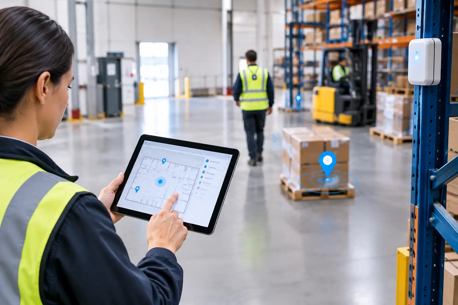
A missed SOS alert, an unverified service visit or a forklift that cannot be found is rarely a reporting problem. It is a location-data problem. The right indoor positioning vendors help organisations establish where people and assets are, how confidently they know it, and what action should follow. The best choice depends on the decision you need to make: room-level attendance, precise worker safety, asset recovery, task verification or an indoor-to-outdoor operational view.
What should indoor positioning vendors be able to prove?
Indoor positioning is the process of determining the location of a person, device or asset inside a building, where satellite GPS signals are often weak or unavailable. A useful system does more than place a dot on a map. It connects a signal from a badge, tag, button or sensor to an operational workflow.
For example, a facilities team may use a worker badge to confirm that a colleague reached the assigned floor before a task begins. The system can then record presence in a defined zone and make the task available. That may only require zone-level certainty.
A lone-worker scenario is different. If a wearable button triggers an SOS alert, the response team may need to know the worker’s location to a much tighter level, such as the relevant room or area, alongside the identity of the person and the time of the alert. The required accuracy, speed of updates and resilience of the supporting infrastructure are therefore higher.
When assessing suppliers, start with the operational question, not a preferred technology:
- What must the system know: presence in a site, a zone, a room or a precise position?
- Which person, asset or event produces the signal?
- How quickly must an alert, task or rule be triggered?
- What action will a supervisor, security team or automated workflow take?
A vendor that cannot translate these questions into a practical design is unlikely to deliver dependable physical-world data.
How indoor positioning vendors differ by technology
There is no single best positioning technology. UWB, Bluetooth Low Energy and GPS each answer different location questions, and many operational environments benefit from a combination.
UWB for precise indoor location decisions
Ultra-wideband, or UWB, measures the time taken for radio signals to travel between a device and fixed infrastructure. In a properly designed deployment, it can support highly precise indoor positioning. This makes it appropriate where the difference between being near an area and being in a specific location affects safety or operations.
Consider a manufacturing site where a worker enters a restricted maintenance zone. A UWB-enabled badge can provide the location evidence needed for a geofenced rule, such as notifying a supervisor or checking whether an authorised process has begun. The value comes from the action enabled by the location certainty, not from precision as a technical trophy.
UWB requires installed infrastructure and careful site design. Metal, machinery, walls, ceiling height and the layout of operational areas can all affect the design. It is often a stronger fit for defined areas where precise positioning is genuinely necessary than for every corridor, car park and remote customer site.
BLE for zones, proximity and scalable coverage
Bluetooth Low Energy, usually shortened to BLE, uses low-power signals from tags, badges, beacons or gateways. It is commonly suited to zone-level presence, proximity and broader indoor coverage requirements.
A hospitality operator could use BLE badges and gateways to identify that a team member is in the relevant service area, supporting task allocation or clocking workflows. An asset tag could show that a mobile piece of equipment remains on the expected ward, floor or department. In both cases, the useful question is often “which area?” rather than “which exact point?”
BLE can be a practical choice where infrastructure scale, device size and operational simplicity matter. Its achievable certainty depends on the environment, gateway placement, device behaviour and the difference between zones. It should not be presented as a substitute for UWB where a safety process requires precise indoor coordinates.
GPS for outdoor and hybrid operations
GPS uses satellite signals and is suited to outdoor location. It is useful for teams travelling between customer sites, social housing estates, construction compounds and dispersed operational locations. It generally cannot deliver dependable indoor positioning through a building structure.
For a mobile engineer, GPS may establish arrival at a customer site. A badge or tag using BLE or UWB can then provide the indoor evidence needed to allocate a task, verify completion in a plant room or support an emergency response. A hybrid architecture avoids forcing one technology to answer every location question.
Compare vendors on the workflow, not the map
A live map is helpful, but it is not an operational outcome. The stronger comparison is whether the platform turns location events into timely, auditable action.
For verified attendance, establish whether the system can distinguish arrival at a site from presence in a designated indoor work area. The device might be a wearable badge; the signal could be BLE or UWB; the resulting event may feed a clocking or workforce-management process. The design must reflect the level of verification required, rather than assuming every shift needs precise tracking.
For proof of completion, ask whether a worker can be identified at the required location when a job is started or completed. A cleaner attending a specific floor, an engineer servicing a plant area or a security officer completing a round may need different location rules. The platform should retain a clear event history without creating unnecessary monitoring outside the task.
For safety, assess the entire alert chain. An SOS button or fall alert is only useful if the system can identify the wearer, establish the relevant location, notify the right people and support a documented response. Ask how alerts work when a device is indoors, outdoors or temporarily away from normal infrastructure.
For assets, define what “found” means. A high-value mobile asset may justify precise positioning. For lower-value equipment, knowing the last known department or the gateway it was near may be sufficient. The tag, infrastructure and maintenance model should match the asset’s operational criticality.
Questions to ask before selecting a supplier
Can the system meet the accuracy your process requires?
Ask vendors to describe accuracy in the context of your environment and use case. Terms such as room-level, zone-level and precise positioning should be tied to a tested site design, not treated as universal promises. Request a walkthrough of difficult areas: plant rooms, loading bays, stairwells, metal-heavy production spaces and exterior transition points.
What infrastructure will be installed and maintained?
Reliable location data depends on the physical layer. Understand where gateways, anchors, beacons and sensors will be located; how they connect; how the estate will be monitored; and who owns ongoing device maintenance. A design that is easy to deploy but difficult to support across 40 sites may create a long-term operational burden.
How will it integrate with existing systems?
Location data has most value when it informs a decision in the systems teams already use. This could include workforce management, facilities software, security operations, task management or a business intelligence environment. Ask what events can be shared, whether integrations support real-time triggers, and how identities, locations and historical records are managed.
Does it work across indoor, outdoor and multi-site estates?
A single hospital, distribution centre or factory has different demands from a mixed estate of offices, customer locations and field teams. Clarify whether the vendor can use the appropriate combination of UWB, BLE and GPS without creating separate, disconnected operational views.
Privacy is part of the technical design
Employee location data requires a clear purpose, proportional collection and transparent communication. The question is not simply whether tracking is possible. It is whether collecting a particular location event is necessary for a legitimate operational, safety or service-delivery purpose.
Define when location is collected, what precision is needed, who can access it and how long it is retained. A clocking workflow may need a time-stamped arrival event, not continuous movement history. A lone-worker safety process may justify more frequent location updates during a shift, with access limited to those managing an incident.
Involve operations, IT, security, health and safety, HR and data-protection stakeholders early. Staff should understand what their device records, why it records it and what does not happen with the data. This improves adoption and helps ensure the system is designed around proportionate use rather than surveillance.
A practical approach to vendor evaluation
Run the evaluation around representative operational journeys. Test a normal shift start, an asset search, a task completed in the wrong area, an emergency alert and a movement from outdoors into the building. Each journey should reveal the device used, the signal received, the location confidence and the action taken.
Then test the exceptions. What happens if a badge is left behind, a gateway loses connectivity, a worker enters an unplanned area or an asset passes between coverage zones? A credible vendor will discuss these limits plainly and explain how the deployment, rules and support model handle them.
Sense Presence is designed for organisations that need a connected view of people, assets and activity across complex environments, using the location technology appropriate to the decision at hand. The sensible next step is a site-specific assessment that begins with your highest-value workflow, not a generic accuracy claim.
The best vendor is the one that gives your teams enough location certainty to protect staff, coordinate work and prove what happened, without collecting more data or installing more infrastructure than the operation truly needs.